


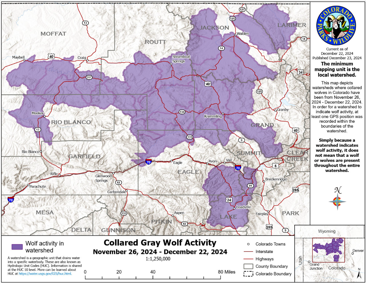
Wolf collar pings south of I-70 once again, as seen in updated tracking map from CPW
Another month has passed and another map tracking wolf movement around the state has been released by Colorado Parks and Wildlife.
The most recent map covers the date range of November 26 through December 22 and keep in mind, the map depicts watershed areas where tracking collars placed on the wolves have been during that timeframe. It doesn’t mean wolves are present in that entire area and it doesn’t mean they’re still present in those watersheds now.
In general, the new mapping doesn’t seem to capture hugely noteworthy movements compared to mapping from last month.
At least one wolf remains south of I-70, in a watershed south of Vail that stretches into Lake County and encompasses Leadville. Meanwhile, at least one wolf pushed farther east into Larimer County, with the watershed area that it was in appearing to be in the area of State Forest State Park. Another key movement that was shown by the tracking collars was a shift by wolves north toward Craig into Moffat County, now absent from most of Garfield County and farther away from Glenwood Springs (see the most recent range on the feature image at the top of this article).
Another key update related to Colorado’s wolf reintroduction effort is that Garfield, Eagle, and Pitkin counties remain on the short list of spots being considered for the next wolf release, likely to take place at some point in early-to-mid 2025.
Find more information about wolves in Colorado here.
Get OutThere
Signup today for free and be the first to get notified on new updates.
PREV
PREVIOUS
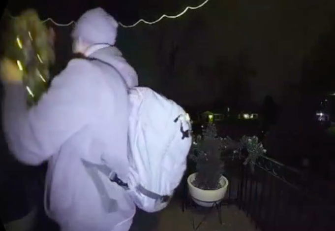
Real-life 'Grinch' caught on camera stealing Christmas decorations in Denver neighborhood
The suspect, wearing a Puma sweatshirt, was seen snatching a Christmas wreath on Dec. 22 at 9:40 p.m.
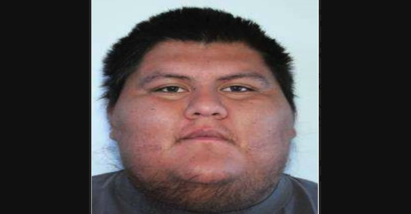
Reward offered after 7-year-old shot and killed at tribal reservation in Colorado
The Federal Bureau of Investigation has announced that a $10,000 reward is being offered for information that leads to the arrest and conviction of a suspect related to a case involving the shooting of a minor on a Native American reservation in Colorado. A federal arrest warrant has been issued for 23-year-old Jeremiah Hight, who […]